Pressure Point Spanish – Bill Bowtell Feb 2016

S-Cape 2 moved along at a touch above idle speed – about 1.5knots. Two flat lines laid out the back – set about 40 metres on the starboard side and 60 metres on the port side. The turn would be to port. This was a deliberate maneuver.
Both baits were hit on the turn and the rods, both short-strokers, bent back hard in the horizontal rod holders. The motor was gunned at the first indication of the hook-up. The 7/0 O’Shaughnassy hooks bit deep into the bony jaws. A successful double.
The fish, the noted, hard-fighting, Spanish mackerel, were allowed to run. They would tire and be easier to turn. For Spanish, unlike a lot of other pelagics, will run with their mouths open, and virtually drown themselves. A few, last ditch attempts for freedom, at the side of the boat, were easily handled and soon two 10kg succulent eating fish graced the ice box.
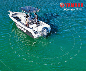
With the fish dressed and iced-down and new baits of ribbonfish (Wolf Herring) freshly rigged, it was back to the head of the reef. No need wasting time looking for fish, the ocean told us where they were – wide of the pressure point! S-Cape 2, my 5.5m Seafarer Viking, an ideal boat for this type of fishing, was repositioned and the troll pattern recommenced. The subtle changes in the ocean were noted.
Back at the head of the north/south run were some well-defined landmarks that pin-pointed this particular reef to within a few metres. As insurance, over the years, I had taken the time to plot the entire area on the big Furuno chart plotter so that its exact layout was known, right down to marking and recording the depth of water at each prominent feature of the reef. This too was deliberate, for it was at the pressure points where the fish were holding and I needed to know where these were forming. And to work these pressure points out I needed to know every feature of the reef and how they interacted with the tidal flow(s).
On this trip, my second run varied by a mere twenty metres from the first, which had produced the double hook-up. But it was necessary, for the “engine room”, that upwelling and rip of the pressure point, had moved. This could be seen by observing the run in the water and to where the current line was now swirling along the outside of the reef. It was different form where it was fifteen minutes ago on our first troll. This was confirmed by the course mapped out on the Furuno GPS plotter.
The run of the swirling current was now located twenty metres to the west and in closer to the eastern face of the north/south orientated reef and the sunken ledge, some twenty below. We travelled just wide of the current line and watched as the sounder plotted all of the characteristics of the sea-floor just wide of the reef. It liked what it saw and lit up like a Christmas tree as we passed a protrusion in the line of the reef and over a hump in the bottom. And the Christmas tree was all Spanish mackerel.
A look back along the path of the troll lines showed them passing into the neutral water – an eddy had formed at the edge of the current line as it was shoved wide by the protrusion in the reef. The fish hit. One was dropped, as the motor was gunned to set the hooks. The other came up solid. Another one for the ice-box.
After two hours of fishing and seven runs of around 300m each, we had our bag limit of fish – all Spanish. The total width of our troll pattern was about 200 metres at the widest point along the south- west face of the reef, down to 100 metres at the point where the reef swung from north/south orientation to south/west. Depths varied from 27 to 18m, as our troll pattern took us from initially, wide of the reef to almost over the near vertical eastern face, then down along the south- western running side. Locating and following pressure points all of the way.
It was interesting to note later as I drew up in my fishing diary, that the area covered in our fishing was about 6 hectares (15 acres in the old scale), which is quite an area of ocean. But what is even more interesting, is that we noted bait schools along every trolling run. We were on top of them at every stage. They moved as the tide progressed and the predators followed. So did we. A check of our original troll path when leaving the area showed little on the sounder. The thinking fisherman will take that one step further when fishing a reef. We had been successful.
Pressure points occur throughout the oceans of the world. Some are of a global magnitude, caused by gravitational pull, rotational spin of the earth, continental and island land masses, prevailing hemispherical winds and sea floor formations. They are of great interest to those involved in national and international marine operations and science. Including fishing. Others are of a local nature.
For most of us, it is those locally created pressure points that form every time a tide ebbs, or floods, that we need to know and understand. For if it helps in our fishing then we need to know both, what they are and how they work. Because the fish do! And they use them to travel, hunt and feed. It makes sense.
The notion of local pressure points was first evidenced in my younger days when I was a keen diver and spearo. It was noticed on more than one occasion, whether diving around reefs, bommies, headlands and even ocean foreshore gutters, that fish acted in certain, and often, specific ways during various phases of tidal flows. It didn’t matter if the phase was run-up or run-down the fish were consistent in their positioning and actions. They always gathered at a pressure point. It made for successful spearing. And being in the water with them, one could get the feel as to why they hung where they did during the tidal flows. It was also visual.
Eventually I went “topside” but never lost the notion of where the fish should be sitting. And undertook early in the piece that, when a patch of country was found, then it was not just good enough to know that a reef, bommie, gutter or headland existed, but to further investigate what lay beyond the feature – get an understanding of the whole picture and how the fish used that area at various stages of the tide.
I found this to be good information because, from my spearing days and actually being in the water with the fish, much of the feeding activity, and gathering of bait schools was noted to occur away from the reef, or structure, as the tide pushed through. Then as the run dropped, the fish would either move back to the reef (a spearo’s delight), or move to a sheltered part beyond the reef, such as a gutter, or hole, and sit. Then, as the flow of the tide again kicked-in, do it all over again.
These distances away from the reef at the time of tidal flows varied. But it is safe to say, that it was always just beyond, or at the very best, on the edge of the tidal run – the current line – the pressure point. Exceptions to this were at those points where there was a noticeable upwelling in the line of the feature, creating an upcurrent. Here the fish would gather in a v-like form in front of the lift with baitfish feeding on the nutrients being lifted from the sea-floor and predators feeding on the baitfish.
Whatever the case, both of these areas do verge on neutral water; they are the “pressure points” of that reef. Points of the reef where the food is brought to the fish! It needs to be understood however that, such points are dynamic and because they are formed by the tide they move with the tide – “PRESSURE POINTS ARE CONTINUALLY CHANGING”. And as the pressure points shift and move, so do the fish, especially Spanish mackerel. The fisherman needs to look for these subtle changes and be prepared to move accordingly. It may be only a matter of metres, but it may also be, the difference between getting a feed, to missing out. Sometimes completely! The fisherman needs to work it out.
A pressure point is formed when the flow of water is interrupted by an obstacle, or feature. As previously mentioned this could be a reef, bommie, rock outcrop, foreshore gutter, coastal headland or island. Even piers and channel markers will break the flow of water and create a pressure point. They all enter the mix.
Everyday fishing technology that most of us use will not indicate that a pressure point has been located. What it will give you however, is all of the algorithms in a formula to understand what is happening in the water around you. Information such as size and shape of a feature, flow rates of the tide, water temp and depth and your location. The rest is the understanding of how a pressure point forms, and how fish use them. It takes a lot of the guess-work out of fishing.
As a general rule it can be considered that – “greater the obstacle and stronger the flow of water, then greater the effect of the pressure point”. Fish will move about during these times of stronger flows, but their time at any one point will be relatively short-lived. Fish do not want to be fighting the elements to get a feed. They want the elements to get them a feed. The fisherman has to be not only observant but also mobile in such circumstances. There are of course some variations to this active movement. Turn-of-the-tide bites. That period when the water goes from near zero movement to a sluggish ebb, or flood, before the main run. That time in the tide which starts all of the action.
I have noted over the years that the initial run of the tide (in either direction) agitates the fish into action. Fish, that have been stationary along a wall of reef, or deep within a gutter, or hole, suddenly begin to rise and fall within a water column as they feel and seek that more oxygenated water created by the tidal flow. Bait schools tend to come together and move in unison whilst the predators, like Spanish, begin to take their first swipe. Fish, who only minutes before were quite content to sit side by side in mock harmony, now become the hunter and the hunted. Some will not see another tide.
At these times fish will sit in very close to the reef, for that is where the pressure point will first be noticed. Then, as the tidal flow increases and the pressure points stream off of the current lines, they will move wide and basically follow a line which is a mirror image of the reef. The effect of the outflow is different.
The old mackerel fishermen often refer to local hotspots on the fishing grounds as “run-up”, or “run-down” spots. In general it means that these specific areas fish better when the tide is either flooding, or ebbing. And they can be very specific spots, even coming down to mere metres in some featured areas and along some current lines. Such spots are created wholly and solely by the movement of water and how the feature pushes and shoves this water to form eddies and currents. Some currents that are very defined and streamlined on the flood tide may be nothing more than an indistinct disturbance on the ebb. As an example.
Liza Jane Shoals is a rock shoal reef located at the southern end of Keppel Bay about 25klm out from the mouth of the Fitzroy River. The rise on its eastern side is relatively sharp when compared to the more gentle western face. From my experience it is a “run-up” spot. Water humps over the reef on the flood tide, pushing current lines directly away to the west to further inshore shoals such as Jabiru, then on towards the mouth of the river. At this peak time the Spanish love it and are rather predictable.
On the ebb tide however, the reef does not have the same impact because of the massive outflow from the mighty Fitzroy river and the shape of the shoal itself. These ebbing waters from the Fitzroy flow along its old submerged channels that were once part of the Fitzroy delta. They are broad and spread both south and north before heading east. The influence on western slopes of the shoals is greatly reduced and the flows are less dramatic. It still attracts the bait schools at this time, but the feeding patterns of the fish chasing them alter. And in some cases, on particular tides, this can be rather dramatic.
My mate, Barry Strickfuss, and I arrived just at the start of the flood tide. The water humped and swirled over the sunken shoal of rock and pushed a big, broken, current line out to the southwest over a raised bottom of sand and shale. Everywhere we looked to the southwest was a seascape of leaping Spanish mackerel and shimmering schools of herring and anchovies. It was mayhem.
In those days we anchored and drifted baits, mainly WA pilchards, but also used 3×2 gar. Our inexperience at that time, lead us to anchor just off the reef and drift our baits back into the current. Initially we caught nothing.
The action to the southwest slowed, and then finally ceased. Only minutes later both of our lines slammed down. Two Spanish mackerel were taken.
This pattern continued for more than three hours – fish would be seen leaping; then nothing; then our lines would take off. We caught fish – all mackerel.
That night over a rum, our discussion was not of how many fish we caught, or how big they were, but when they took our drifting baits of pilchards.
It was soon realized that we were only picking up the school as they move from, then back to, the main feature of the reef, as the bait schools moved. At all other times they had corralled the bait at the pressure point and were feeding freely. In later years when we started to rig baits and troll, it was these areas of pressure, which we targeted.
A new phase in our fishing had begun.